
 Français
 Italiano
Size of this PNG preview of this SVG file: 388 × 600 pixels. Other resolutions: 155 × 240 pixels | 310 × 480 pixels | 497 × 768 pixels | 662 × 1,024 pixels | 1,325 × 2,048 pixels | 1,687 × 2,608 pixels.
Original file (SVG file, nominally 1,687 × 2,608 pixels, file size: 551 KB)
This is a file from the Wikimedia Commons and may be used by other projects. Information from its description page there is shown below. Commons is a freely licensed media file repository. |
Summary
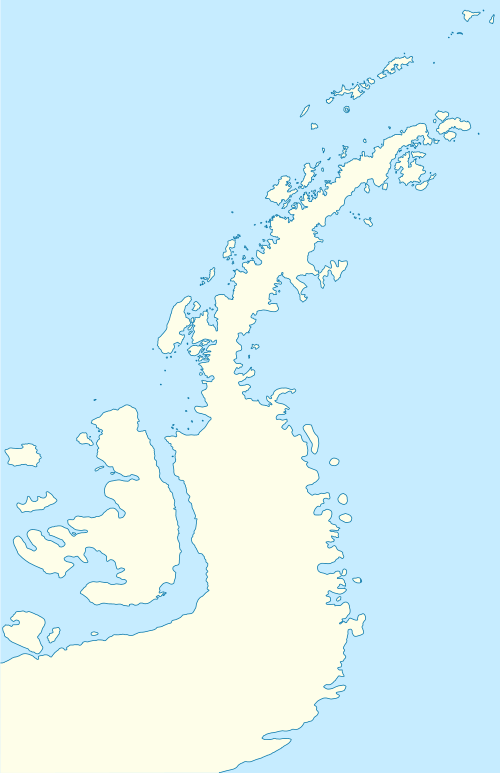
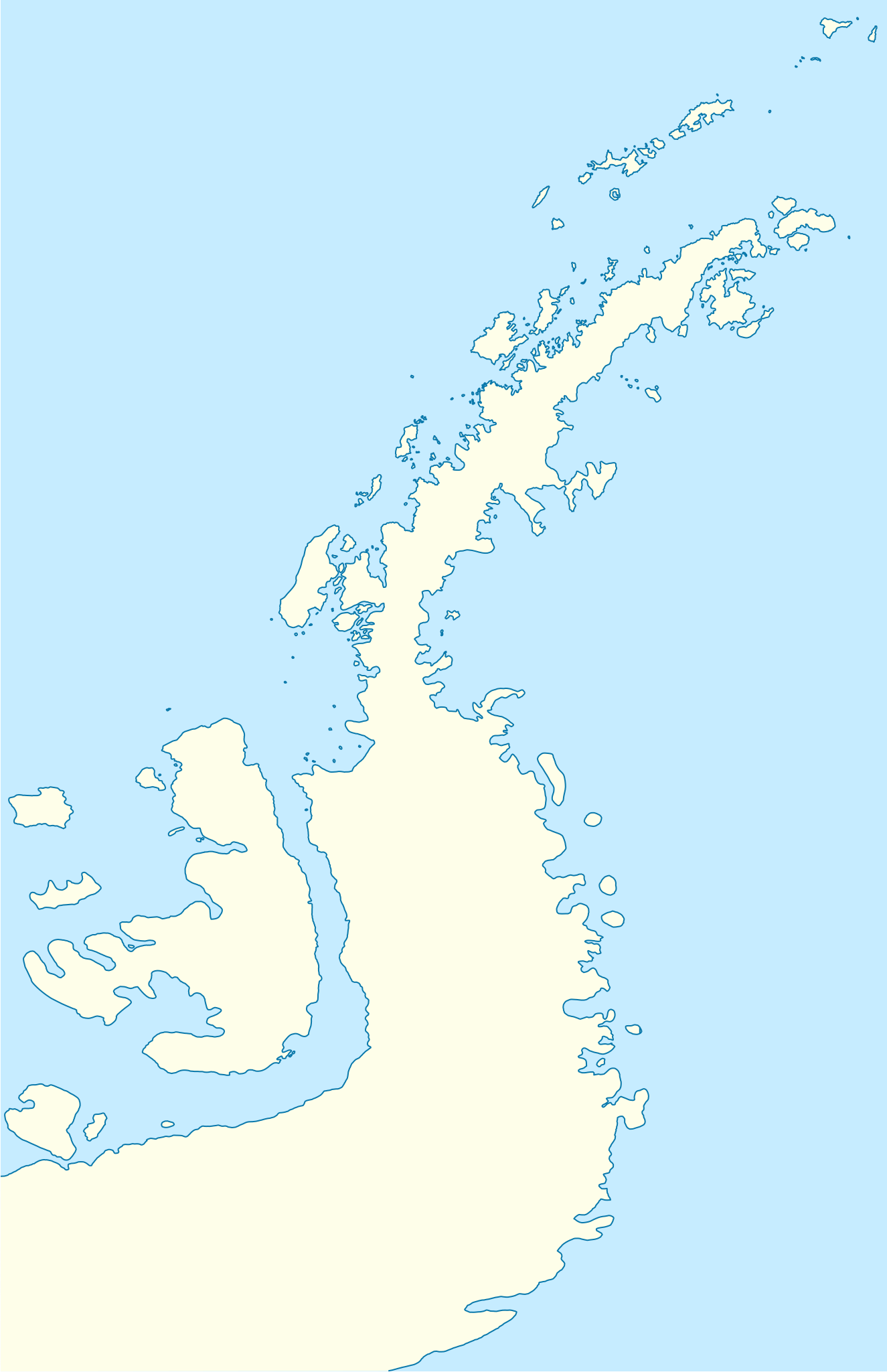
| Description | Deutsch: Positionskarte der Antarktischen Halbinsel Quadratische Plattkarte, N-S-Streckung 230 %. Geographische Begrenzung der Karte:
English: Location map of the Antarctic Peninsula Equirectangular projection, N/S stretching 230 %. Geographic limits of the map:
| ||
| Date | |||
| Source | own work, using United States National Imagery and Mapping Agency data | ||
| Author | NordNordWest |

Licensing
I, the copyright holder of this work, hereby publish it under the following licenses:
 | Permission is granted to copy, distribute and/or modify this document under the terms of the GNU Free Documentation License, Version 1.2 or any later version published by the Free Software Foundation; with no Invariant Sections, no Front-Cover Texts, and no Back-Cover Texts. A copy of the license is included in the section entitled GNU Free Documentation License. |
This file is licensed under the Creative Commons Attribution 3.0 Unported license.
- You are free:
- to share – to copy, distribute and transmit the work
- to remix – to adapt the work
- Under the following conditions:
- attribution – You must give appropriate credit, provide a link to the license, and indicate if changes were made. You may do so in any reasonable manner, but not in any way that suggests the licensor endorses you or your use.
You may select the license of your choice.
File history
Click on a date/time to view the file as it appeared at that time.
| Date/Time | Thumbnail | Dimensions | User | Comment | |
|---|---|---|---|---|---|
| current | 07:50, 31 March 2009 | | 1,687 × 2,608 (551 KB) | NordNordWest | corr |
| 08:22, 30 March 2009 |  | 1,684 × 2,608 (550 KB) | NordNordWest | corr | |
| 08:04, 30 March 2009 |  | 1,684 × 2,608 (551 KB) | NordNordWest | {{Information |Description= {{de|Positionskarte der Antarktischen Halbinsel}} Quadratische Plattkarte, N-S-Streckung 230 %. Geographische Begrenzung der Karte: * N: 60.8° S * S: 76.0° S * W: 73.6° W * O: 54.8° W {{en|Loc |
File usage
There are no pages that use this file.
Global file usage
The following other wikis use this file:
- Usage on ar.wikipedia.org
- Usage on ba.wikipedia.org
- Usage on bg.wikipedia.org
- Гринуич (остров)
- Берое (хълм)
- Якоруда (ледник)
- Шаблон:ПК Антарктически полуостров
- Неговански камък
- Абрит (нунатак)
- Агалина (ледник)
- Алдомировски хребет
- Алтимир (ледник)
- Алцек (нунатак)
- Райна Касабова (ледник)
- Ами Буе (връх)
- Андреев нунатак
- Антонов връх
- Армира (ледник)
- Ариплери (проток)
- Юндола (залив)
- Чубра (връх)
- Чернопеев (връх)
- Цончо Чапанов (връх)
- Чакъров връх
- Хохщетер (връх)
- Димитров (залив)
- Додунеков връх
- Алексиев (ледник)
- Пърличев (хребет)
- Злокучене (ледник)
- Зверино (остров)
- Бона Мансио (остров)
- Usage on ceb.wikipedia.org
- Usage on da.wikipedia.org
- Usage on de.wikipedia.org
- Usage on en.wikipedia.org
View more global usage of this file.
Explore the world

United states
New York

Japan
Tokyo

Singapore
Singapore
