
 Français
 Italiano
Size of this PNG preview of this SVG file: 610 × 599 pixels. Other resolutions: 244 × 240 pixels | 489 × 480 pixels | 782 × 768 pixels | 1,042 × 1,024 pixels | 2,085 × 2,048 pixels | 1,425 × 1,400 pixels.
Original file (SVG file, nominally 1,425 × 1,400 pixels, file size: 1.14 MB)
This is a file from the Wikimedia Commons and may be used by other projects. Information from its description page there is shown below. Commons is a freely licensed media file repository. |
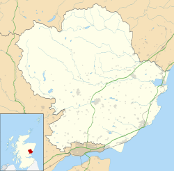
| Description | Blank map of Angus, UK with the following information shown:
Equirectangular map projection on WGS 84 datum, with N/S stretched 180% Geographic limits:
|
| Date | |
| Source |
|
| Author | Nilfanion, created using Ordnance Survey data |
| Permission (Reusing this file) | This file is licensed under the Creative Commons Attribution-Share Alike 3.0 Unported license. Attribution: Contains Ordnance Survey data © Crown copyright and database right
|
| Other versions | File:Angus UK blank map.svg - Blank map |
File history
Click on a date/time to view the file as it appeared at that time.
| Date/Time | Thumbnail | Dimensions | User | Comment | |
|---|---|---|---|---|---|
| current | 20:01, 26 September 2010 | | 1,425 × 1,400 (1.14 MB) | Nilfanion | {{Information |Description=Blank map of Angus, UK with the following information shown: *Administrative borders *Coastline, lakes and rivers *Roads and railways *Urban areas Equirectangular map projection on WGS 84 datum, with N/S stretched 18 |
File usage
There are no pages that use this file.
Global file usage
The following other wikis use this file:
- Usage on ar.wikipedia.org
- Usage on ba.wikipedia.org
- Usage on bg.wikipedia.org
- Usage on br.wikipedia.org
- Usage on ceb.wikipedia.org
- Usage on de.wikipedia.org
- Usage on en.wikipedia.org
- Angus, Scotland
- Arbroath
- Glamis Castle
- List of monastic houses in Scotland
- Forfar
- Montrose, Angus
- Kirriemuir
- Colliston Castle
- Brechin
- Friockheim
- Carnoustie
- Glamis
- Aberlemno
- Memus
- Airlie, Angus
- Monifieth
- Liff, Angus
- Craigowl Hill
- Edzell Castle
- East Haven, Angus
- Station Park, Forfar
- Wikipedia:WikiProject Scottish Castles
- Tealing
- RAF Montrose
- Glebe Park, Brechin
- Barry, Angus
- Strathmartine
- Auchmithie
- Scottish Junior Football East Region Premier League North
- Cortachy
- Stracathro
- Bridge of Craigisla
- Carmyllie
- Edzell
- Farnell, Angus
- Guthrie, Angus
- Inverkeilor
- Letham, Angus
- Newbigging, Angus
- Murroes
- St Vigeans
View more global usage of this file.
Explore the world

United states
New York

Japan
Tokyo

Singapore
Singapore
