
 Français
 Italiano
Size of this preview: 800 × 533 pixels. Other resolutions: 320 × 213 pixels | 640 × 427 pixels | 1,024 × 683 pixels | 1,280 × 853 pixels | 2,496 × 1,664 pixels.
Original file (2,496 × 1,664 pixels, file size: 1.11 MB, MIME type: image/jpeg)
This is a file from the Wikimedia Commons and may be used by other projects. Information from its description page there is shown below. Commons is a freely licensed media file repository. |
Summary
| Camera location | | View this and other nearby images on: OpenStreetMap |
|---|
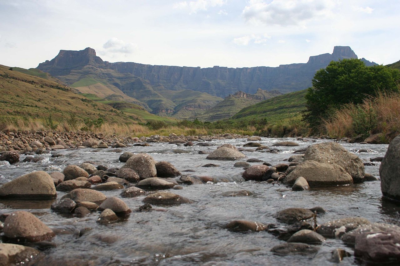
| Description | Afrikaans: Gesig op die Drakensbergamfiteater vanaf die Tugelarivier se boloop, KwaZulu-Natal, Suid-Afrika English: View of the Drakensberg amphitheatre as from the upper Tugela River, KwaZulu-Natal, South Africa |
| Date | 8 January 2007 (uploaded) |
| Source | Taken by Rudolph Botha on 21 October 2006. Image taken from en.wiki ([1]) |
| Author | User:Bothar |
| Permission (Reusing this file) | Released into public domain |
![[1]](https://en.wikipedia.org/wiki/Image:Amphitheatre_Drakensberg.jpg)
Original upload log
* (del) (cur) 07:37, 8 January 2007 . . Bothar (Talk | contribs) . . 2496×1664 (1,166,280 bytes) (Taken by Rudolph Botha on 2006/10/21. View of the Amphitheatre as from the Tugela River, South Africa.)
Licensing
| This work has been released into the public domain by its author, Bothar at English Wikipedia. This applies worldwide. In some countries this may not be legally possible; if so: Bothar grants anyone the right to use this work for any purpose, without any conditions, unless such conditions are required by law. |
File history
Click on a date/time to view the file as it appeared at that time.
| Date/Time | Thumbnail | Dimensions | User | Comment | |
|---|---|---|---|---|---|
| current | 13:36, 30 May 2007 | | 2,496 × 1,664 (1.11 MB) | Jalo | Image taken from en.wiki ([http://en.wikipedia.org/wiki/Image:Amphitheatre_Drakensberg.jpg]) ==Original description== Taken by Rudolph Botha on 2006/10/21. View of the Amphitheatre as from the Tugela River, South Africa. ==Original history== <pre> * (d |
File usage
The following 2 pages use this file:
Global file usage
The following other wikis use this file:
- Usage on af.wikipedia.org
- Usage on azb.wikipedia.org
- Usage on be-tarask.wikipedia.org
- Usage on ca.wikipedia.org
- Usage on ceb.wikipedia.org
- Usage on cs.wikipedia.org
- Usage on en.wikipedia.org
- Usage on es.wikipedia.org
- Usage on et.wikipedia.org
- Usage on fr.wikipedia.org
- Usage on he.wikipedia.org
- Usage on hr.wikipedia.org
- Usage on it.wikipedia.org
- Usage on it.wikivoyage.org
- Usage on lt.wikipedia.org
- Usage on ml.wikipedia.org
- Usage on ms.wikipedia.org
- Usage on my.wikipedia.org
- Usage on nn.wikipedia.org
- Usage on no.wikipedia.org
- Usage on pl.wikipedia.org
- Usage on pt.wikipedia.org
- Usage on ru.wikipedia.org
- Usage on sh.wikipedia.org
- Usage on sk.wikipedia.org
- Usage on ss.wikipedia.org
- Usage on sv.wikipedia.org
- Usage on sw.wikipedia.org
- Usage on uk.wikipedia.org
- Usage on www.wikidata.org
- Usage on xmf.wikipedia.org
- Usage on zh.wikipedia.org
Metadata
Explore the world

United states
New York

Japan
Tokyo

Singapore
Singapore
