
 Français
 Italiano
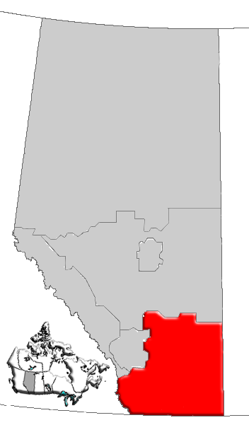
Size of this preview: 341 × 599 pixels. Other resolutions: 136 × 240 pixels | 352 × 618 pixels.
Original file (352 × 618 pixels, file size: 35 KB, MIME type: image/png)
This is a file from the Wikimedia Commons and may be used by other projects. Information from its description page there is shown below. Commons is a freely licensed media file repository. |
Summary
| Description | Map of Southern Alberta, Canada |
| Date | |
| Source | GIS data |
| Author | Qyd (talk · contribs) |
| Permission (Reusing this file) | All |
Licensing
| I, the copyright holder of this work, release this work into the public domain. This applies worldwide. In some countries this may not be legally possible; if so: I grant anyone the right to use this work for any purpose, without any conditions, unless such conditions are required by law. |
File history
Click on a date/time to view the file as it appeared at that time.
| Date/Time | Thumbnail | Dimensions | User | Comment | |
|---|---|---|---|---|---|
| current | 16:18, 4 January 2007 | | 352 × 618 (35 KB) | Qyd | {{Information |Description=Map of Southern Alberta, Canada |Source=GIS data |Date=Jan 2006 |Author={{User|Qyd}} |Permission=All |other_versions= }} Category:Maps of Alberta |
File usage
There are no pages that use this file.
Global file usage
The following other wikis use this file:
- Usage on de.wikipedia.org
- Usage on en.wikipedia.org
- Judith River Group
- Eagle Butte crater
- Eagle Butte, Alberta
- Clark Range (Rocky Mountains)
- Carway, Alberta
- Milk River Ridge
- Crowsnest River
- Welling, Alberta
- Diamond City, Alberta
- Castle Mountain Resort
- Craigmyle, Alberta
- Richdale
- Scotfield
- Brocket, Alberta
- Dunmore, Alberta
- Schuler, Alberta
- Askow, Alberta
- Elkwater Lake (Alberta)
- Mount Tyrwhitt
- Southern Alberta
- Westward Ho, Alberta
- Huxley, Alberta
- Pembina oil field
- Horseshoe Canyon (Alberta)
- Del Bonita, Alberta
- Gleichen, Alberta
- Rolling Hills, Alberta
- Orion, Alberta
- Bircham, Alberta
- Hesketh, Alberta
- Sunnyslope, Alberta
- Wimborne, Alberta
- Milk River Ridge Reservoir
- Lake Newell
- Etzikom Coulee
- Kipp Coulee
- Purple Springs
- Mountain View, Alberta
- Enchant, Alberta
- Mount Blakiston
- Buffalo, Alberta
- Altorado, Alberta
- Walsh, Alberta
- High River (provincial electoral district)
- Pakowki Lake
- Aetna, Alberta
- Ardenode, Alberta
- Atlee, Alberta
- Beazer, Alberta
View more global usage of this file.
Explore the world

United states
New York

Japan
Tokyo

Singapore
Singapore
