
 Français
 Italiano
Size of this preview: 341 × 599 pixels. Other resolutions: 136 × 240 pixels | 352 × 618 pixels.
Original file (352 × 618 pixels, file size: 37 KB, MIME type: image/png)
This is a file from the Wikimedia Commons and may be used by other projects. Information from its description page there is shown below. Commons is a freely licensed media file repository. |
Summary
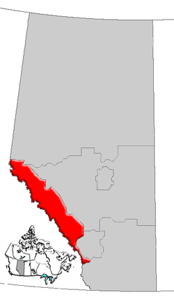
| Description | Map of Rockies Region, Alberta, Canada |
| Date | |
| Source | GIS data |
| Author | Qyd (talk · contribs) |
| Permission (Reusing this file) | All |
Licensing
| I, the copyright holder of this work, release this work into the public domain. This applies worldwide. In some countries this may not be legally possible; if so: I grant anyone the right to use this work for any purpose, without any conditions, unless such conditions are required by law. |
File history
Click on a date/time to view the file as it appeared at that time.
| Date/Time | Thumbnail | Dimensions | User | Comment | |
|---|---|---|---|---|---|
| current | 16:29, 4 January 2007 | | 352 × 618 (37 KB) | Qyd | {{Information |Description=Map of Rockies Region, Alberta, Canada |Source=GIS data |Date=Jan 2006 |Author={{User|Qyd}} |Permission=All |other_versions= }} Category:Maps of Alberta |
File usage
There are no pages that use this file.
Global file usage
The following other wikis use this file:
- Usage on de.wikipedia.org
- Usage on en.wikipedia.org
- Castle Junction
- Mount Mitchell (Alberta)
- Mount GEC
- Gong Peak
- Mount Weiss
- Mount Palmer (Alberta)
- Mount Nelson (Alberta)
- Thorington Tower
- Mount Adam Joachim
- Mount Morden Long
- Mount McGuire (Alberta)
- Mount Confederation
- Little Alberta
- Warwick Mountain
- Mount King Edward
- Hidden Lake (Alberta)
- Mount Brazeau
- Mount Andromeda (Alberta)
- Beatrice Peak
- Isabelle Peak
- Haiduk Peak
- Mount Charles Stewart
- Fossil Mountain (Alberta)
- Mount Chester
- Mount Cornwell (Canada)
- Mount Cory (Alberta)
- Bare Range
- Blue Range
- Peyto Lake
- Heart Mountain (Alberta)
- Athabasca Falls
- Bow Falls
- Mount Baldy (Alberta)
- Spirit Island (Alberta)
- Elbow Falls
- Bow Valley
- Canyon Creek Ice Cave
- Sentinel Peak (Alberta)
- Lake Agnes (Alberta)
- Panther Mountain (Alberta)
- Mount Aylmer
- Massive Range
- Division No. 15, Alberta
- Medicine Lake (Alberta)
- Athabasca Glacier
- Trapper Peak (Canada)
- Abbot Pass
- Black Rock Mountain (Alberta)
- Vermilion Lakes
View more global usage of this file.
Explore the world

United states
New York

Japan
Tokyo

Singapore
Singapore
