
 Français
 Italiano
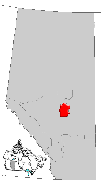
Size of this preview: 341 × 599 pixels. Other resolutions: 136 × 240 pixels | 352 × 618 pixels.
Original file (352 × 618 pixels, file size: 32 KB, MIME type: image/png)
This is a file from the Wikimedia Commons and may be used by other projects. Information from its description page there is shown below. Commons is a freely licensed media file repository. |
Summary
| Description | Map of Edmonton Region, Alberta, Canada |
| Date | |
| Source | GIS data |
| Author | Qyd (talk · contribs) |
| Permission (Reusing this file) | All |
Licensing
| I, the copyright holder of this work, release this work into the public domain. This applies worldwide. In some countries this may not be legally possible; if so: I grant anyone the right to use this work for any purpose, without any conditions, unless such conditions are required by law. |
File history
Click on a date/time to view the file as it appeared at that time.
| Date/Time | Thumbnail | Dimensions | User | Comment | |
|---|---|---|---|---|---|
| current | 16:29, 4 January 2007 | | 352 × 618 (32 KB) | Qyd | {{Information |Description=Map of Edmonton Region, Alberta, Canada |Source=GIS data |Date=Jan 2006 |Author={{User|Qyd}} |Permission=All |other_versions= }} Category:Maps of Alberta |
File usage
There are no pages that use this file.
Global file usage
The following other wikis use this file:
- Usage on de.wikipedia.org
- Usage on en.wikipedia.org
- Kavanagh, Alberta
- Lakeview, Alberta
- Knottwood, Edmonton
- Menisa, Edmonton
- Delton, Edmonton
- Elmwood, Edmonton
- Avonmore, Edmonton
- Evergreen, Edmonton
- Lorelei, Edmonton
- Lee Ridge, Edmonton
- Argyll, Edmonton
- Jasper Park, Edmonton
- Belle Rive, Edmonton
- Klarvatten, Edmonton
- Brintnell, Edmonton
- Windermere, Edmonton
- Silver Berry, Edmonton
- Wild Rose, Edmonton
- Ridgewood, Edmonton
- Lakewood, Edmonton
- Burnewood, Edmonton
- Westview Village, Edmonton
- Hudson, Edmonton
- Elmwood Park, Edmonton
- Woodvale, Edmonton
- Millhurst, Edmonton
- Southwood, Edmonton
- Millbourne, Edmonton
- Maple Ridge, Edmonton
- Breckenridge Greens, Edmonton
- Rutherford, Edmonton
- Cumberland, Edmonton
- Oxford, Edmonton
- Carlton, Edmonton
- MacEwan, Edmonton
- Cameron Heights, Edmonton
- Rapperswill, Edmonton
- Chambery, Edmonton
- Place LaRue, Edmonton
- Carter Crest, Edmonton
- Schonsee, Edmonton
- The Hamptons, Edmonton
- Donsdale, Edmonton
- Suder Greens, Edmonton
- Stewart Greens, Edmonton
- Hollick-Kenyon, Edmonton
- Whitemud Creek
- Blackmud Creek, Edmonton
- Callaghan, Edmonton
View more global usage of this file.
Explore the world

United states
New York

Japan
Tokyo

Singapore
Singapore
