
 Français
 Italiano
Size of this preview: 341 × 599 pixels. Other resolutions: 136 × 240 pixels | 352 × 618 pixels.
Original file (352 × 618 pixels, file size: 33 KB, MIME type: image/png)
This is a file from the Wikimedia Commons and may be used by other projects. Information from its description page there is shown below. Commons is a freely licensed media file repository. |
Summary
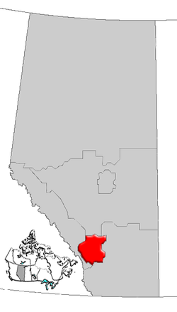
| Description | Map of Calgary Region Alberta, Canada |
| Date | |
| Source | GIS data |
| Author | Qyd (talk · contribs) |
| Permission (Reusing this file) | All |
Licensing
| I, the copyright holder of this work, release this work into the public domain. This applies worldwide. In some countries this may not be legally possible; if so: I grant anyone the right to use this work for any purpose, without any conditions, unless such conditions are required by law. |
File history
Click on a date/time to view the file as it appeared at that time.
| Date/Time | Thumbnail | Dimensions | User | Comment | |
|---|---|---|---|---|---|
| current | 16:28, 4 January 2007 | | 352 × 618 (33 KB) | Qyd | {{Information |Description=Map of Northern Alberta, Canada |Source=GIS data |Date=Jan 2006 |Author={{User|Qyd}} |Permission=All |other_versions= }} Category:Maps of Alberta |
File usage
There are no pages that use this file.
Global file usage
The following other wikis use this file:
- Usage on de.wikipedia.org
- Usage on en.wikipedia.org
- Aldersyde, Alberta
- Priddis Greens
- Sheep River (Alberta)
- Benchlands
- Stoney 142, 143, 144
- Kathyrn
- Keoma, Alberta
- Madden, Alberta
- Glenbow, Alberta
- Bottrel
- Cochrane Lake, Alberta
- Conrich
- Elbow Valley, Alberta
- Dalemead
- Dalroy
- Delacour, Alberta
- Indus, Alberta
- Janet, Alberta
- Confederation Park, Calgary
- Heritage Pointe
- Hartell, Alberta
- Chestermere Lake
- Carseland
- Foothills Nordic Ski Club
- Cowboys Park
- Sikome Lake
- Cedarbrae, Calgary
- Template:CalgaryRegion-geo-stub
- Castleridge, Calgary
- Centennial Place (Calgary)
- Blackie, Alberta
- Ghost Lake
- Ghost Lake, Alberta
- Waiparous
- Priddis, Alberta
- Redwood Meadows
- Ralph Klein Park
- Millarville
- User:Volker.haas/PositionAbsolute
- Artists View Park West, Alberta
- Heritage Woods, Alberta
- High Point Estates, Alberta
- Azure, Alberta
- Bennett, Alberta
- List of historic places in the Calgary Region
- Vortex (Calaway Park)
- West Village, Calgary
- Big Hill (Alberta)
- Stoney 142B
View more global usage of this file.
Explore the world

United states
New York

Japan
Tokyo

Singapore
Singapore
