
 Français
 Italiano
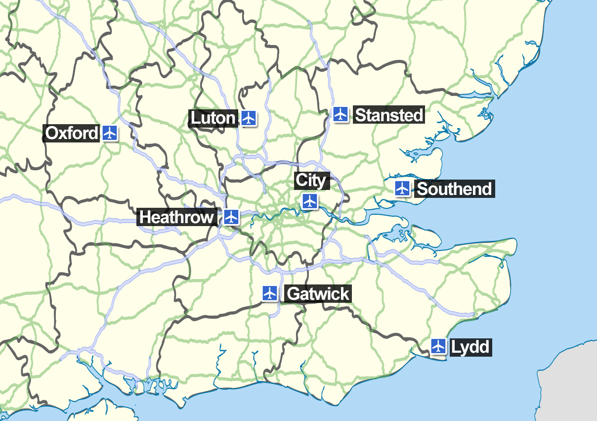
Size of this preview: 800 × 564 pixels. Other resolutions: 320 × 225 pixels | 640 × 451 pixels | 1,024 × 721 pixels | 1,208 × 851 pixels.
Original file (1,208 × 851 pixels, file size: 448 KB, MIME type: image/png)
This is a file from the Wikimedia Commons and may be used by other projects. Information from its description page there is shown below. Commons is a freely licensed media file repository. |
Summary
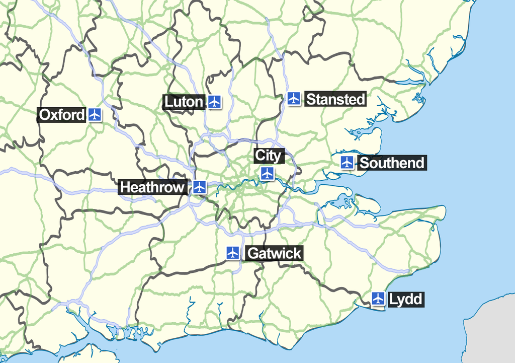
| Description | English: Map of the locations of airports serving the London region in the UK: (ltr) Oxford (OXF) - Heathrow (LHR) - Luton (LTN) - Gatwick (LGW) - City (LCY) - Stansted (STN) - Southend (SEN) - Lydd (LYX). See also: en:Airports of London & en:Category:Airports in the London region. Note Lydd and Oxford have short runways and specialise in short-hop, charter/private, non-scheduled flights. |
| Date | |
| Source | File:A38 UK road map.svg |
| Author | Nilfanion |
Licensing
This file is licensed under the Creative Commons Attribution-Share Alike 3.0 Unported license.
- You are free:
- to share – to copy, distribute and transmit the work
- to remix – to adapt the work
- Under the following conditions:
- attribution – You must give appropriate credit, provide a link to the license, and indicate if changes were made. You may do so in any reasonable manner, but not in any way that suggests the licensor endorses you or your use.
- share alike – If you remix, transform, or build upon the material, you must distribute your contributions under the same or compatible license as the original.
File history
Click on a date/time to view the file as it appeared at that time.
| Date/Time | Thumbnail | Dimensions | User | Comment | |
|---|---|---|---|---|---|
| current | 10:04, 28 February 2012 | | 1,208 × 851 (448 KB) | Wikidwitch |
File usage
The following page uses this file:
Global file usage
The following other wikis use this file:
- Usage on af.wikipedia.org
- Usage on ar.wikipedia.org
- Usage on de.wikipedia.org
- Usage on en.wikipedia.org
- Usage on fr.wikipedia.org
- Usage on he.wikivoyage.org
- Usage on it.wikipedia.org
- Usage on uk.wikipedia.org
- Usage on uz.wikipedia.org
- Usage on www.wikidata.org
Metadata
Explore the world

United states
New York

Japan
Tokyo

Singapore
Singapore
