
 Français
 Italiano
Size of this preview: 800 × 473 pixels. Other resolutions: 320 × 189 pixels | 640 × 378 pixels | 1,024 × 605 pixels | 1,280 × 756 pixels | 2,560 × 1,513 pixels | 5,659 × 3,344 pixels.
Original file (5,659 × 3,344 pixels, file size: 3.81 MB, MIME type: image/jpeg)
This is a file from the Wikimedia Commons and may be used by other projects. Information from its description page there is shown below. Commons is a freely licensed media file repository. |
Summary
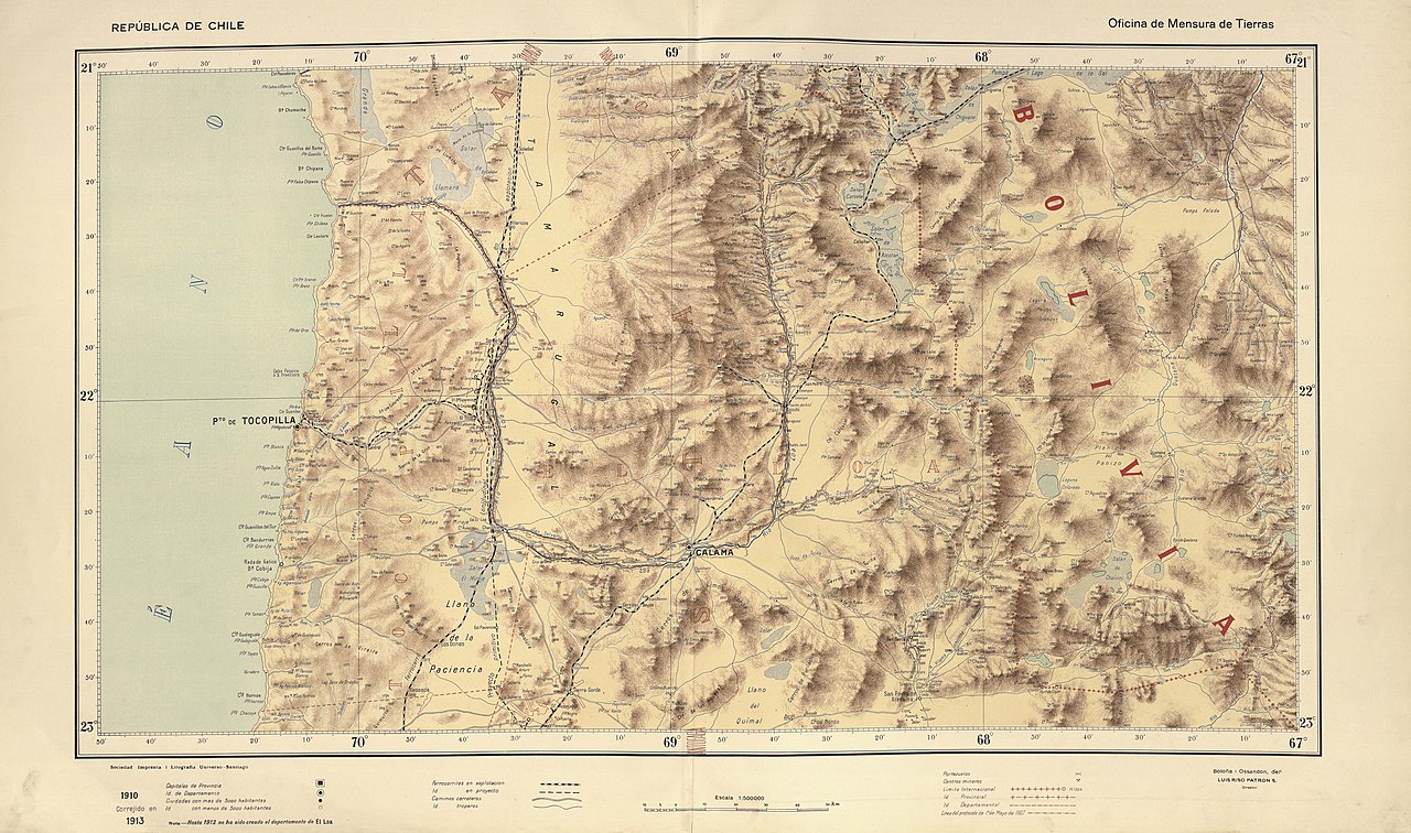
| Description | Español: Los mapas provinciales del “Atlas Centenario”, surgen de la preocupación del Presidente Pedro Montt por contar con un buen mapa de Chile. Los mapas fueron encargados a don Luis Risopatrón, director de la Oficina de Mensura de Tierras. Para la realización de este importante encargo presidencial, Risopatrón contó con la colaboración de los cartógrafos don Nicanor Boloña y Dañino y don Luis Ossandón y Cressy, quienes compilaron todos aquellos trabajos cartográficos disponibles a la fecha. El total de hojas que componen el mapa alcanza a 22 y se fueron editando entre 1908 y 1911, abarcando desde los 17° a los 57° grados de latitud sur. Su título oficial es: “Mapa de Chile. Ejecutado por orden de S.E. el Presidente de la República Excmo. Señor don Pedro Montt. Oficina de Mensura de Tierras. Edición Centenaria 1910.” |
| Date | |
| Source | file:Risopatron-mapas-MC0073683-arica-temuco 01.pdf file:Risopatron-mapas-MC0073683-valdivia-cabo-de-hornos.pdf |
| Author | Nicanor Boloña y Dañino, Luis Ossandón y Cressy, Luis Risopatrón |
| Other versions |
.jpg)
Licensing
| This work is in the public domain in its country of origin and other countries and areas where the copyright term is the author's life plus 70 years or fewer. This work is in the public domain in the United States because it was published (or registered with the U.S. Copyright Office) before January 1, 1930. | |
| This file has been identified as being free of known restrictions under copyright law, including all related and neighboring rights. | |
File history
Click on a date/time to view the file as it appeared at that time.
| Date/Time | Thumbnail | Dimensions | User | Comment | |
|---|---|---|---|---|---|
| current | 16:20, 6 April 2020 | | 5,659 × 3,344 (3.81 MB) | Juan Villalobos | Uploaded a work by Nicanor Boloña y Dañino, Luis Ossandón y Cressy, Luis Risopatrón from file:Risopatron-mapas-MC0073683-arica-temuco 01.pdf file:Risopatron-mapas-MC0073683-valdivia-cabo-de-hornos.pdf with UploadWizard |
File usage
There are no pages that use this file.
Global file usage
The following other wikis use this file:
- Usage on es.wikipedia.org
- Usuario:Tony Rotondas/Sandbox
- Río Silala
- Cerro Zapaleri
- Río Salado (Loa)
- Río San Salvador (Loa)
- El Tatio
- Salar de Llamara
- Salar de Carcote
- Salar de Ascotán
- Río Puritama
- Río Vilama
- Río Salado (San Pedro de Atacama)
- Embalse Conchi
- Río Putana
- Quebrada Iquine
- Laguna Blanca (Bolivia-Chile)
- Río Puripica
- Río Jauna
- Río Pélon
- Tranque de relaves Talabre
- Río Huiculunche
- Quebrada Amarga
Explore the world

United states
New York

Japan
Tokyo

Singapore
Singapore
