
 Français
 Italiano
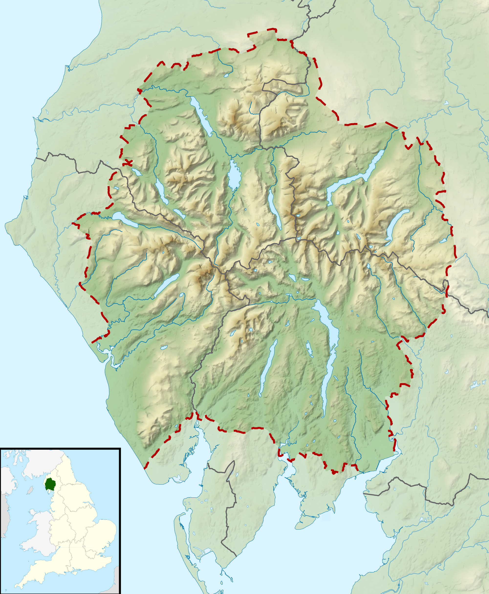
Größe dieser Vorschau: 494 × 600 Pixel. Weitere Auflösungen: 198 × 240 Pixel | 395 × 480 Pixel | 632 × 768 Pixel | 843 × 1.024 Pixel | 2.001 × 2.430 Pixel.
Originaldatei (2.001 × 2.430 Pixel, Dateigröße: 3,62 MB, MIME-Typ: image/png)
| Beschreibung | Relief map of the Lake District National Park, UK Equirectangular map projection on WGS 84 datum, with N/S stretched 170% Geographic limits:
|
| Datum | |
| Quelle | Office of National Statistics Geography
|
| Urheber | Nilfanion, created using Ordnance Survey data |
| Genehmigung (Weiternutzung dieser Datei) | Diese Datei ist unter der Creative-Commons-Lizenz „Namensnennung – Weitergabe unter gleichen Bedingungen 3.0 nicht portiert“ lizenziert. Namensnennung: Contains Ordnance Survey data © Crown copyright and database right
|
Dateiversionen
Klicke auf einen Zeitpunkt, um diese Version zu laden.
| Version vom | Vorschaubild | Maße | Benutzer | Kommentar | |
|---|---|---|---|---|---|
| aktuell | 12:51, 17. Mär. 2012 | | 2.001 × 2.430 (3,62 MB) | Nilfanion | {{Information |Description=Relief map of the Lake District National Park, UK Equirectangular map projection on WGS 84 datum, with N/S stretched 170% Geographic limits: *West: 3.65W *East: 2.60W *North: 54.80N *South: 54.05N |Sourc... |
Dateiverwendung
Die folgende Seite verwendet diese Datei:
Globale Dateiverwendung
Die nachfolgenden anderen Wikis verwenden diese Datei:
- Verwendung auf ar.wikipedia.org
- Verwendung auf ceb.wikipedia.org
- Verwendung auf en.wikipedia.org
- Lake District
- Derwentwater
- Scafell Pike
- Windermere
- Coniston Water
- Scafell
- Helvellyn
- Wast Water
- Thirlmere
- Skiddaw
- List of lakes of the Lake District
- Bassenthwaite Lake
- Ullswater
- Buttermere
- Old Man of Coniston
- Dent (fell)
- Pillar (Lake District)
- Great Gable
- Bowfell
- Fairfield (Lake District)
- Great End
- Catstye Cam
- Blencathra
- Skiddaw Little Man
- Crinkle Crags
- Haweswater Reservoir
- Ennerdale Water
- Hard Knott
- Harter Fell (Eskdale)
- Whitbarrow
- Great Dodd
- High Street (Lake District)
- Pavey Ark
- Dale Head
- Robinson (Lake District)
- Place Fell
- Little Mell Fell
- Grayrigg Forest
- Hallin Fell
- Grasmoor
- Cold Pike
- Gummer's How
- Whitfell
- High Raise (Langdale)
- Kirkby Moor
- Cat Bells
- Nethermost Pike
- Esk Pike
Weitere globale Verwendungen dieser Datei anschauen.
Metadaten
Explore the world

United states
New York

Japan
Tokyo

Singapore
Singapore
